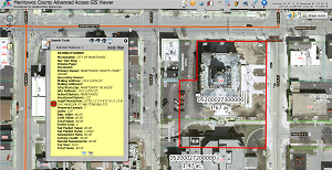
GIS ViewerThis link will bring you to a GIS website containing multiple data layers and tools. Information for Manitowoc County and the City of Manitowoc is updated monthly. Information for the City of Two Rivers is from January 1, 2019.
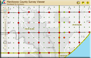
Public Land Survey System ViewerThis website provides access to Public Land Survey System (PLSS) information including tie sheets, section summaries, and Plat of Surveys. Certified Survey Maps and other recorded survey maps are available on the Register of Deeds Land Records website. Data are updated monthly.
Soil & Water Conservation Dept. GIS MapsThis link takes you to a collection of interactive maps created and maintained by the Soil & Water Conservation Department.
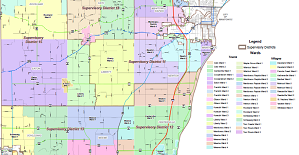
Manitowoc County Supervisory Districts & WardsLinks to 4 different Supervisory Districts and Wards maps. Last updated on 7/1/2016.
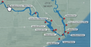
Twin Rivers Water TrailInteractive story map of the Twin Rivers Water Trail. Created by Bay-Lake Regional Planning Commission in 2018.
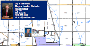
City of Manitowoc OfficialsThis map shows the Elected Officials and Aldermanic Districts in the City of Manitowoc.
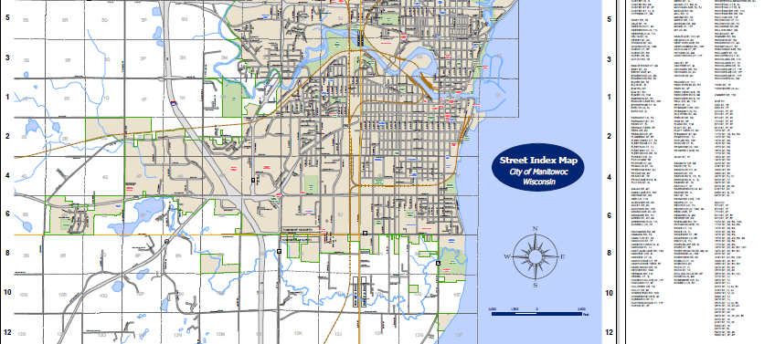
City of Manitowoc Street Index MapIn addition to streets, this City map shows parks, schools, and many other points of interest.
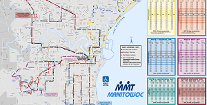
Maritime Metro Transit RoutesFollow this link to download route maps or see a list of locations where you can pick up maps at no charge. Maritime Metro Transit will even mail you a copy.
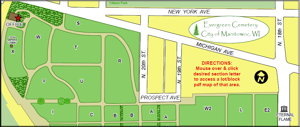
Evergreen Cemetery MapEvergreen Cemetery is owned and operated by the City of Manitowoc. This PDF map shows the cemetery’s layout by sections, lots, and blocks.
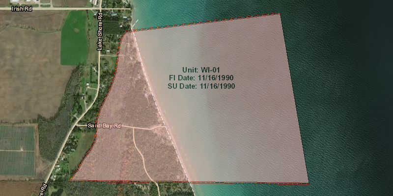
Coastal Barrier Resources System (CBRS)The Coastal Barrier Resources Act (CRBA) of 1982 and subsequent amendments established the John H. Chafee Coastal Barrier Resources System (CRBS) and is administered by the U.S Fish and Wildlife Service.